- Focus on Nature Based Solutions – here
- Focus on Oceans – Here
Friday, Jan 13 at 12:30 pm – Ontario Greens leader Mike Schreiner in conversation with Dr. Rebecca Rooney about the vital role of Ontario’s wetlands, how the Ford government’s recent legislative changes put them at risk, and why it’s so important to ensure their protection.
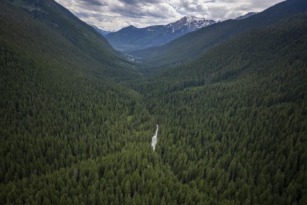
B.C.’s Incomappleux Valley of ancient trees, rare animals preserved
January 26th 2023 – Canadian Press
A valley of giant trees, lakes and wetlands in southeastern British Columbia nearly 200 times the size of Vancouver’s Stanley Park is being preserved in an agreement with governments, Indigenous groups, a forest company and the Nature Conservancy of Canada.
The partnership to protect the Incomappleux Valley east of Revelstoke, B.C., involves Interfor Corp. giving up about 75,000 hectares of its forest tenure.
The valley is a rare inland temperate rainforest with substantial areas of mature and old-growth trees, some ranging in age from 800 to 1,500 years.
All the Ontario environmental protections Doug Ford wants to overhaul
to build more houses
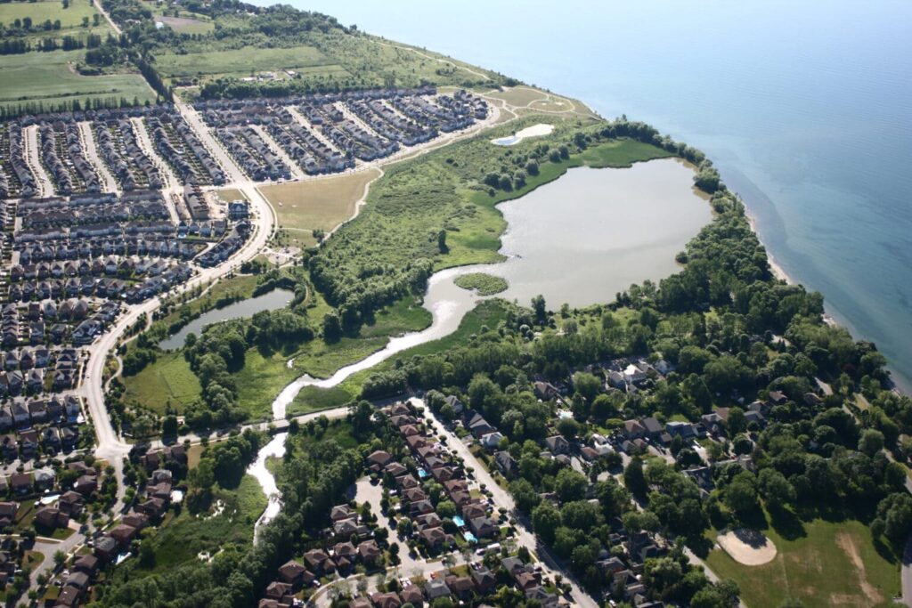
Photo: Toronto and Region Conservation Authority
Nov. 3, 2022 – The Narwhal – By Fatima Syed and Emma McIntosh
Doug Ford’s government proceeded with a controversial plan to rapidly expand housing construction, despite receiving “confidential” warnings from public servants about sweeping environmental risks to parks, wetlands, conservation areas, farms and Indigenous territory.
Aiming to reduce developers’ ‘regulatory obligations’ around Ontario’s parks, protected spaces and wetlands, the Ford government also wants to limit residents’ ability to object. – The rest of the story
Muskoka Community Land Trust seeks support to create more affordable housing options
Dec 13, 2021 – Doppler Online

Suzanne Martineau and Melinda Zytaruk, representing the Muskoka Community Land Trust, were before Lake of Bays Council at its December 7 meeting asking for municipal support for a land trust housing initiative. You can find the presentation to the council – Here.
Are the world’s peatlands better protected after COP26?
Dec 7, 2021 – Carbon Brief – Guest post
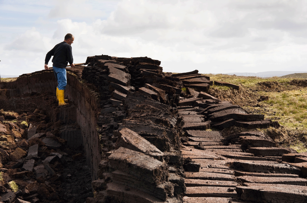
Peatlands cover just 3% of the world’s land area, but store twice as much carbon as all the trees on Earth combined.
The carbon held in these wetlands has been accumulating for millennia and may be “irrecoverable”. This means that, once released, the carbon in the soil would take centuries to re-establish – way beyond the timescales relevant for tackling climate change.
Hamilton Votes to End Sprawl: Stop Sprawl Hamilton saves thousands of acres & sets a precedent for the GTHA
November 26, 2021 – Phil Pothen – Environment Defence

In a game-changing victory for the people of Hamilton and the future of the region’s forests and farmland, Hamilton’s City Council has voted by a 13-3 margin to END URBAN SPRAWL.
The city council, supported by an overwhelming 90 per cent of citizens, committed to stopping sprawl – not by stopping or resisting population growth – but by accommodating the next 30 years of new homes and workplaces within Hamilton’s existing boundaries.
Groundbreaking Study Highlights How Design and Development Decisions Affect Embodied Carbon
The lessons of a study from Halifax, Canada can be applied anywhere.
Lloyd Alter – November 1, 2021 – Treehugger
Many booming cities are desperately short of housing and developers are responding with even taller buildings. Many urbanists believe this is a good thing, although studies have shown that life-cycle and operating emissions increase with building height. This is why I have always pitched what I called the “Goldilocks Density,”…
Find more on Embodied Carbon – here
The Muskoka GeoHub
Search and Visualize GIS Data, Maps and Applications
*NEW* – The Muskoka GeoHub now has a new feature in the GeoHub Floodline and LIDAR mapping application that displays a water level station layer, showing water levels across the region in real time.
We All Belong To a Watershed
While 95 per cent of Ontario’s population lives in watersheds managed by a Conservation Authority, we in Muskoka do not. Learn more about Muskoka’s watershed in We All Belong To a Watershed — MLA Yearbook 2020.
Provincially Significant Wetlands no longer safe from development
The Government of Ontario is showing its true colours with recent moves to ride roughshod over protections for Provincially Significant Wetlands.
Please join Ontario Nature in urging the Government of Ontario to respect and uphold protections for Provincially Significant Wetlands and to stop its misuse of Minister’s Zoning Orders.
Sign Now
The Natural Edge
Shorelines are one of the richest environments on earth, but they are also among the most threatened. Muskoka Watershed Council is excited to offer Watersheds Canada’s popular The Natural Edge program in the Muskoka area.
Afforestation
Forests sequester (take up and store) significant amounts of carbon from the atmosphere. When land is converted to forest, growing trees increase the carbon intake capacity of that land and the carbon stored in forest plants and soils.
In the Kyoto Protocol, afforestation is defined as the “direct human-induced conversion of land that has not been forested for a period of at least 50 years to forest land” (UNFCCC 2001). Canada uses the definition of 1 hectare minimum area and 25% canopy cover of trees that have the potential to reach 5 metres height at maturity.